

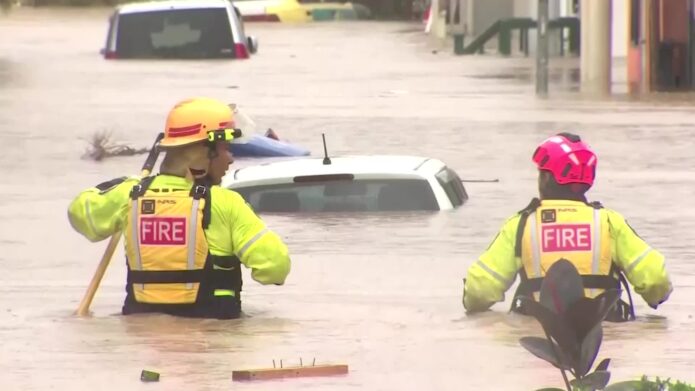


PHOTO: A groundbreaking new nationwide flood map has revealed that more than 750,000 New Zealanders are currently living in areas at risk of major flooding. FILE
🌍 Source: Earth Sciences NZ
⚠️ Flood Risk Rising: Up to 900,000 New Zealanders Could Be Impacted
A groundbreaking new nationwide flood map has revealed that more than 750,000 New Zealanders are currently living in areas at risk of major flooding — a figure projected to surge to 900,000 if global temperatures rise by 3°C.
The findings come from a five-year research programme led by Earth Sciences New Zealand, which has just launched the country’s first consistent nationwide flood hazard viewer.
💻 The interactive online tool lets Kiwis see whether their homes, workplaces, or communities fall within high-risk flood zones — and how that risk could change under future climate scenarios.
🧠 “Better to Know Than to Find Out the Hard Way”
“Currently, around 750,000 people are affected — with three degrees of warming, that could rise to 900,000,” said Dr Emily Lane, Principal Hazards Scientist at Earth Sciences NZ.
“That’s the number of people whose houses are directly exposed to flooding.”
But Lane warned the indirect impacts stretch much further.
“Even if your house doesn’t flood — if you can’t get to work, your children can’t get to school, or supply chains break down — the effects ripple through the community.”
🗺️ A New National Picture
The new Flood Hazard Viewer complements existing council flood maps, uniting them under one national umbrella.
It provides street-level insight across the country and links to regional models where available — filling in the gaps where local data is missing.
“One of the best things you can do to keep people safe is having them know they are in a hazardous place,” said Lane.
“It might be uncomfortable, but knowledge saves lives.”
🏠 Check Before You Buy
The viewer is freely available online — and Lane says every home buyer should use it.
“Insurance companies already have this kind of data. It’s only fair that everyday New Zealanders can access it too.”
The message is clear: don’t sign anything until you’ve checked the flood risk.
💰 $235 Billion in Buildings at Stake
The study estimates that $235 billion worth of property and infrastructure is already exposed to flood hazards — rising to $288 billion if the climate warms by 3°C.
“That’s just current housing,” Lane said. “If we keep building in flood-prone areas, it’ll only get worse.”
Her call to action: smarter planning and stronger long-term vision.
“We can’t afford to build in the wrong places anymore. The first step to resilience is not repeating the same mistakes.”

🌊 Towards a National Flood Map
The Government has since announced plans for a new official National Flood Map, integrating rainfall and coastal flood data into one comprehensive model.
Dr Lane says the groundwork laid by this project is pivotal:
“This shows it’s possible — and crucial. The national map will bring together freshwater flooding, coastal risks, and council data right down to individual homes.”
How will the proportion of people exposed to flooding change?
The percentage of people exposed to flooding will increase in all regions with every extra degree of warming compared to the 1986-2005 average.
🧭 Adaptation Starts with Awareness
Flood resilience, Lane says, begins with information.
“Adaptation is vital — but it starts with knowing where the risks are. Awareness is the foundation of resilience.”
With the new viewer, New Zealand now has a powerful tool to face its rising waters — and a chance to make smarter, safer choices before the next storm hits.

🌐 Explore the National Flood Hazard Viewer
🔗 Visit: Earth Sciences New Zealand Flood Map Viewer
🛰️ See your property’s flood exposure, plan smarter, and stay informed.